Install
Sabanalarga, Atlántico, Colombia Weather
Current conditions
Forecast for this hour (no station report in the last two hours)
Forecast
10-day-
Tuesday
Heavy rain. High 30°. Precipitation 6.0 mm for the day.
-
Tuesday Night
Heavy rain. Low 26°. Precipitation 6.0 mm for the day.
-
Wednesday
Heavy rain. High 30°. Precipitation 11.3 mm for the day.
MET Norway forecast updated 4 hrs ago.
Hourly
Hourly forecast- Now30°
- 12:0030°
- 13:0030°0.2
- 14:0030°1.3
- 15:0028°0.2
- 16:0027°
- 17:0027°
- 18:0027°
- 19:0027°
- 20:0027°0.2
- 21:0026°
- 22:0026°0.8
- 23:0026°3.3
- Wed00:0024°1.7
- 01:0024°0.8
- 02:0024°0.8
- 03:0024°0.2
- 04:0024°
- 05:0024°
- 06:0024°
- 07:0024°
- 08:0025°
- 09:0026°
- 10:0028°
10-day forecast
Details- TodayOct 20Heavy rain6.0 mm26°30°
- WedOct 21Heavy rain11.3 mm24°30°
- ThuOct 22Heavy showers6.7 mm24°31°
- FriOct 23Rain5.3 mm25°31°
- SatOct 24Heavy rain12.0 mm25°30°
- SunOct 25Heavy rain15.4 mm24°30°
- MonOct 26Heavy rain11.7 mm24°29°
- TueOct 27Heavy showers10.8 mm24°31°
- WedOct 28Heavy rain10.7 mm24°29°
- ThuOct 29Rain5.0 mm23°30°
Radar
Full mapWeather news near Sabanalarga
More weather news- Bunker Fuel Tightens in US Gulf as Weather Disrupts Operations
Sea fog may also impede bunker deliveries in the US Gulf early on Friday. The likelihood of fog off Galveston is high from midnight until midday on Friday, with visibility expected to fall to two nautical miles in the…
-
 LatAm Expat & Nomad Daily Guide for Tuesday, October 20, 2026
LatAm Expat & Nomad Daily Guide — Tuesday, October 20, 2026 As of 12:30 a.m. US Eastern Time (ET) · 1:30 a.m. Brasília, Tuesday 20 October 2026 · storm bulletin to Monday night, rates to the latest published fixing…
-
 Kingdom to see mild weather through Monday
Jordan, 18 Other Countries Condemn Colombia’s Opening of Embassy in Jerusalem Amman, Oct. 16 (Petra)-- The Kingdom is expected to experience mild weather across most regions on Friday, while conditions will remain…
-
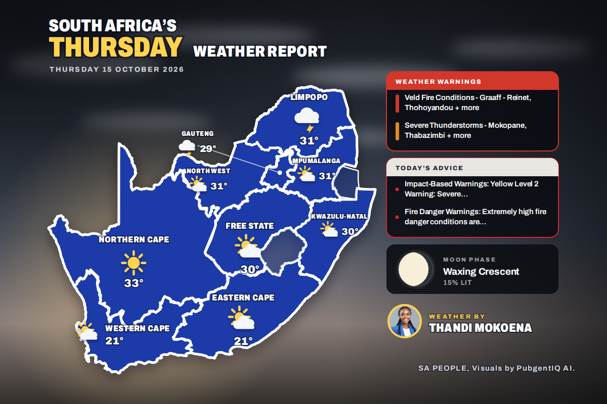 Here is today’s weather by province: Limpopo on alert as severe storms target Mokopane and Thabazimbi
Home » Here is today’s weather by province: Limpopo on alert as severe storms target Mokopane and Thabazimbi Kimberley is the hottest spot at 32°C, while Bloemfontein swings from a chilly 12°C to 30°C and Polokwane…
-
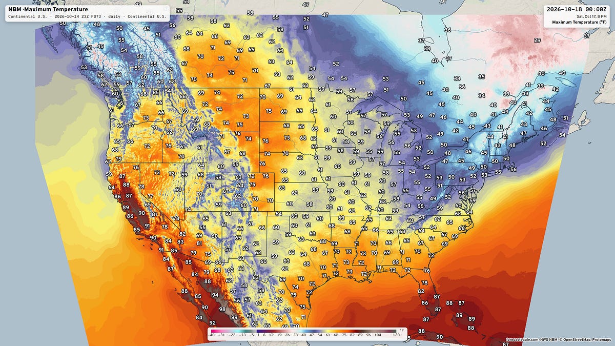 October 14, 2026 Wednesday Weather Update
This is Forecast Post number 1049 — Day 287 of 2026 Day 136 of Atlantic Hurricane Season | YTD: 9 Named Storms, ACE = 18.0 NE Pacific Hurricane Season: YTD: 22 Named Storms, ACE = 321 Author: Dr. Ryan Maue (X…
-
 LatAm Expat & Nomad Daily Guide for Wednesday, October 14, 2026
Panama: schools and daily routines. Panama’s education ministry (Meduca) said on Tuesday 13 October that the gradual reopening of public schools begins on Wednesday 14 October, once safety inspections are done. Minister…
Sun & moon
Nearby
- Barranquilla 41 km
- Soledad 36 km
- Malambo 30 km
- Baranoa 18 km
- Sabanagrande 25 km
- Sitionuevo 27 km
- Pivijay 38 km
- Santo Tomás 23 km
- Luruaco 25 km
- Palmar de Varela 22 km
- Puerto Colombia 40 km
- Mahates 53 km
Forecasts, observations and alerts in the United States come from the National Weather Service (NOAA); radar from NOAA's Multi-Radar Multi-Sensor system; satellite imagery from NASA's Global Imagery Browse Services (GIBS) and NOAA's GOES satellites; the map from the U.S. Geological Survey's National Map; air quality from AirNow (EPA and its partners); hurricane information from the National Hurricane Center; climate normals and records from NOAA's Regional Climate Centers (ACIS). Forecasts outside the United States and the UV index: MET Norway (CC BY 4.0); observations outside the U.S.: airport reports via NOAA's Aviation Weather Center. Place names: GeoNames (CC BY 4.0). Data are copied on a schedule and may lag the sources; for warnings that affect your safety, follow your local National Weather Service office and emergency officials. Weather news is drawn from the 4Conservative index and reflects what the press published. Terms of use.