Install
María la Baja, Bolívar, Colombia Weather
Current conditions
Forecast for this hour (no station report in the last two hours)
Forecast
10-day-
Sunday
Heavy rain. High 29°. Precipitation 29.9 mm for the day.
-
Sunday Night
Heavy rain. Low 25°. Precipitation 29.9 mm for the day.
-
Monday
Heavy rain. High 27°. Precipitation 44.3 mm for the day.
MET Norway forecast updated 1 day ago.
Hourly
Hourly forecast- Now25°
- 07:0026°
- 08:0026°0.2
- 09:0027°0.2
- 10:0029°0.4
- 11:0029°4.4
- 12:0027°1.3
- 13:0027°6.1
- 14:0026°2.3
- 15:0026°0.9
- 16:0026°0.7
- 17:0026°0.9
- 18:0026°0.3
- 19:0026°
- 20:0026°
- 21:0026°1.9
- 22:0025°5.3
- 23:0025°2.7
- Mon00:0025°2.1
Daily forecast
DetailsRadar
Full mapWeather news in Colombia
More weather news-
 Rain returns to Modesto area. What’s ahead going into next week?
The first measurable precipitation since late May arrived in Modesto on Wednesday afternoon. The National Weather Services predicts less than a 10th of an inch during the day. There will be a clearing later into the…
-
 Cool mornings, mild afternoons continue with dry weather ahead
(WSPA)—More cool mornings and mild afternoons ahead, and we stay clear and dry. Wednesday's highs reach the low to mid 70s for much of the area. Temperatures dip into the mid-40s and near 40 in the mountains, under a…
-
 LatAm Expat & Nomad Daily Guide for Tuesday, October 20, 2026
LatAm Expat & Nomad Daily Guide — Tuesday, October 20, 2026 As of 12:30 a.m. US Eastern Time (ET) · 1:30 a.m. Brasília, Tuesday 20 October 2026 · storm bulletin to Monday night, rates to the latest published fixing…
-
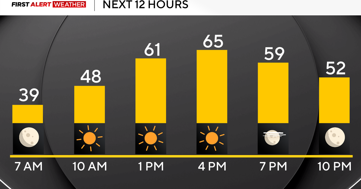 Pittsburgh's stretch of sunshine and dry weather continues on Sunday
October 25, 2026 / 7:07 AM EDT / CBS Pittsburgh High pressure sticks around all weekend long and into the work week with sunny skies, dry conditions, and highs above normal in the mid to upper 60s and even low 70s!…
-
 More wet and windy weather to follow stormy weekend
Choppy seas and large waves crashing up onshore in Aberystwyth, Ceredigion Storm Boelo will continue to batter parts of the UK on Sunday but the fierce autumn weather shows no sign of clearing quickly. After two named…
-
 Storm Boelo: warnings in place in Scotland, Northern Ireland and north of England as high winds batter UK
Met Office reports gusts of 80mph in exposed coastal spots and advises people in affected areas to stay indoors Strong winds have battered Scotland, Northern Ireland and northern England overnight, as Storm Boelo hit…
-
 Rain on Halloween? L.A. could have its first wet Halloween in a decade
The reprieve from rain is expected to last just a few more days as forecasters warn of another storm system that could bring Los Angeles its first rainy Halloween since 2014. It’s still too far out to know the exact…
-
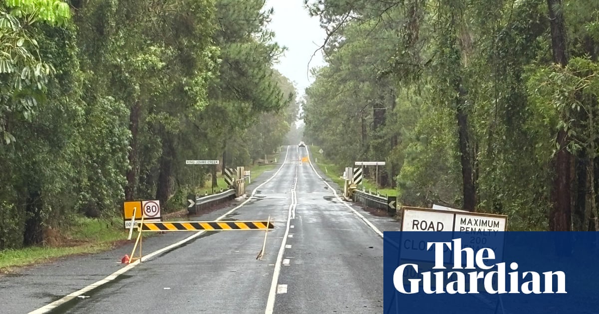 ‘Unusually large’ multi-state storm causing severe weather for Australia’s east – with more on the way
BoM predicts hail, damaging winds, flash flooding and power outages across southern Queensland, western NSW, the ACT and eastern Victoria on Sunday afternoon Large parts of eastern Australia were put on alert for severe…
-
 First Alert Weather: Freezing temps overnight for some parts of New York - 10/24/26
CBS News - The 5:33 | Legacy of the LIRR Massacre - On The Dot with David Schechter: Wildfires & Climate Change First Alert Weather: Freezing temps overnight for some parts of New York - 10/24/26 Trump, Obama make…
-
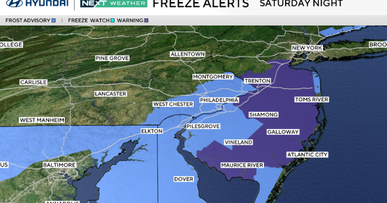 Frosty start to Sunday in Philadelphia region; fabulous fall weather for Eagles-Cowboys Monday
October 24, 2026 / 11:38 PM EDT / CBS Philadelphia Sunday will be a beautiful fall day in the Philadelphia region with plenty of sunshine, light winds and temperatures beginning to moderate after another frosty start…
Sun & moon
Nearby
- Cartagena 51 km
- Turbaco 40 km
- Arjona 31 km
- El Carmen de Bolívar 36 km
- San Pablo 8 km
- San Juan Nepomuceno 24 km
- San Onofre 37 km
- Santiago de Tolú 60 km
- Mahates 30 km
- San Jacinto 26 km
- Santa Rosa 52 km
- San Estanislao 49 km
Forecasts, observations and alerts in the United States come from the National Weather Service (NOAA); radar from NOAA's Multi-Radar Multi-Sensor system; satellite imagery from NASA's Global Imagery Browse Services (GIBS) and NOAA's GOES satellites; the map from the U.S. Geological Survey's National Map; air quality from AirNow (EPA and its partners); hurricane information from the National Hurricane Center; climate normals and records from NOAA's Regional Climate Centers (ACIS). Forecasts outside the United States and the UV index: MET Norway (CC BY 4.0); observations outside the U.S.: airport reports via NOAA's Aviation Weather Center. Place names: GeoNames (CC BY 4.0). Data are copied on a schedule and may lag the sources; for warnings that affect your safety, follow your local National Weather Service office and emergency officials. Weather news is drawn from the 4Conservative index and reflects what the press published. Terms of use.