Install
Gbrakro, Lacs District, Côte d'Ivoire Weather
Current conditions
Forecast for this hour (no station report in the last two hours)
Forecast
10-day-
Thursday
Mostly sunny. High 31°. Precipitation 3.0 mm for the day.
-
Thursday Night
Heavy showers. Low 24°. Precipitation 3.0 mm for the day.
-
Friday
Light showers. High 31°. Precipitation 4.3 mm for the day.
MET Norway forecast updated 3 hrs ago.
Hourly
Hourly forecast- Now30°
- 18:0029°1.1
- 19:0027°1.8
- 20:0025°
- 21:0025°
- 22:0024°
- 23:0024°
- Fri00:0024°
- 01:0023°
- 02:0023°
- 03:0023°
- 04:0023°
- 05:0023°
- 06:0022°
- 07:0023°
- 08:0025°
- 09:0026°
- 10:0027°0.2
- 11:0028°0.2
- 12:0030°
- 13:0030°
- 14:0031°
- 15:0031°
- 16:0031°0.5
10-day forecast
DetailsRadar
Full mapWeather news
More weather news-
 Minnesota gets 3 more days in the 70s, then a cold front cuts the weekend in half | Oct. 22, 2026
Thursday and likely Friday and Saturday all reach the mid 70s, then a cold front moves through Saturday evening and night, dropping highs into the 50s Sunday and the lower 50s Monday through Wednesday, WCCO…
-
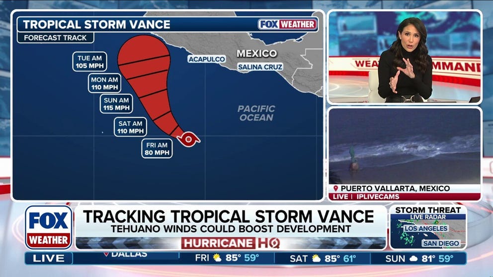 Tropical Storm Vance could intensify into a major hurricane, while Champi threatens Taiwan and Japan
Tropical Storm Vance is expected to strengthen into the 13th hurricane in the Pacific Basin this season as it approaches Mexico next week. Vance could intensify into a major hurricane, which would be the basin's 10th…
-
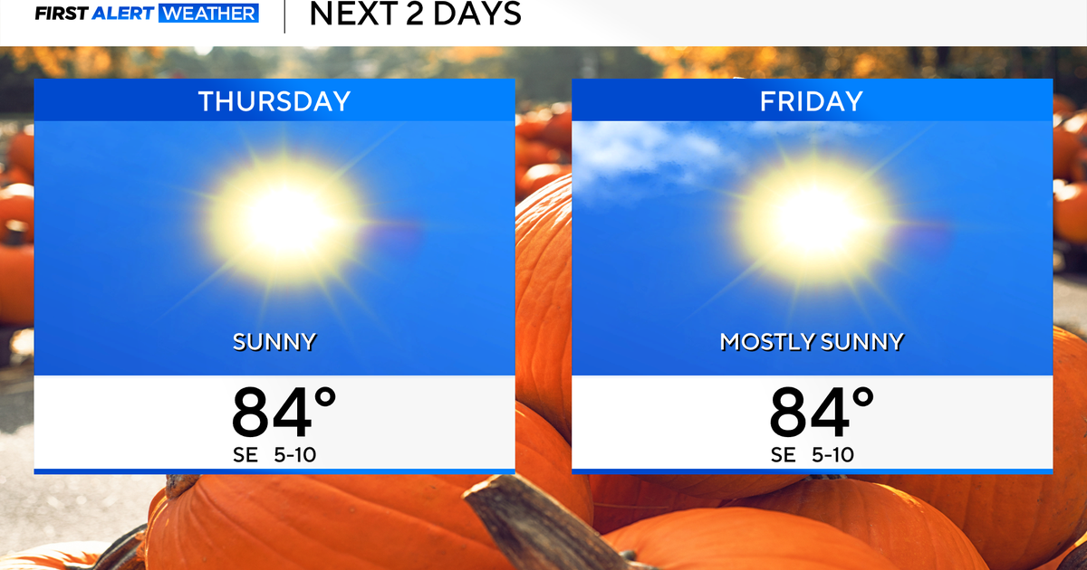 Temperatures to stay in 80s through weekend as clouds increase across North Texas
October 22, 2026 / 7:57 AM CDT / CBS Texas Temperatures are in the 50s and low 60s when you step outside to start your day. The forecast is almost identical to Wednesday, with sunshine and highs in the 80s in store for…
-
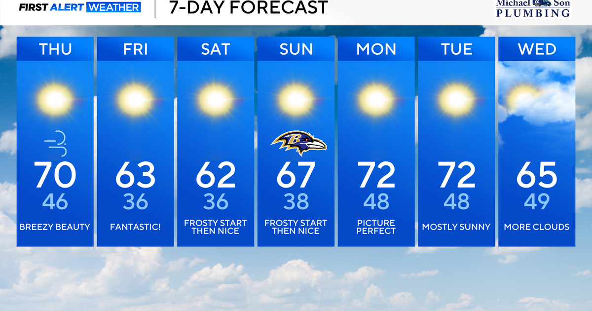 Classic fall weather for Maryland to enjoy through the weekend
Updated on: October 22, 2026 / 8:47 AM EDT / CBS Baltimore Subtropical Storm Josephine, which has been over 500 miles offshore, will continue its journey out to sea. This means rough surf, beach erosion, and coastal…
-
 Weather warning in place ahead of Storm Boelo
Strong winds of up to 75mph could cause disruption across parts of Northern Ireland this weekend as Storm Boelo moves in. A Met Office weather warning has been issued from 18:00 BST on Saturday until 15:00 GMT on…
-
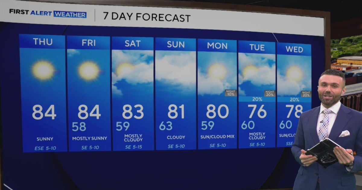 Cloudy, warm weekend on deck as temperatures stay in the low 80s in North Texas
CBS News Baltimore 8am CBS News Boston 8am CBS News Chicago 7am CBS News Colorado This Morning 6am CBS News Los Angeles Mornings 5am CBS News Miami 8am CBS News New York 8am CBS News Texas 7am
-
 Amazing fall weather in Minnesota | Oct. 22, 2026
CBS News Baltimore 8am CBS News Boston 8am CBS News Chicago 7am CBS News Colorado This Morning 6am CBS News Los Angeles Mornings 5am CBS News Miami 8am CBS News New York 8am CBS News Texas 7am
-
 Summery fall warmth continues Thursday in Twin Cities ahead of weekend cooldown
October 22, 2026 / 6:38 AM CDT / CBS Minnesota Thursday will be mostly sunny and mild in the Twin Cities with highs in the mid 70s. Friday will be another warm day in the 70s, with a few clouds and isolated showers…
-
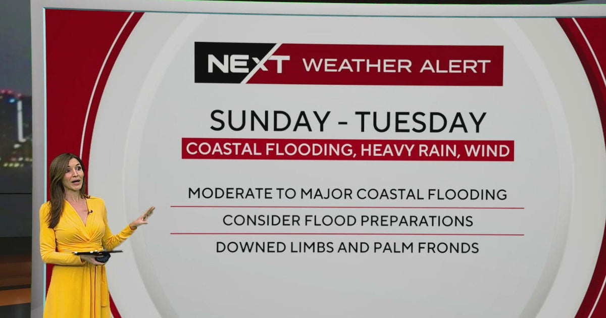 South Florida sees spotty showers ahead of weekend flooding, strong wind threats
October 22, 2026 / 7:30 AM EDT / CBS Miami South Florida will see warmer temperatures and spotty afternoon showers Thursday as the region prepares for a stretch of wet and windy weather that could bring heavy downpours…
-
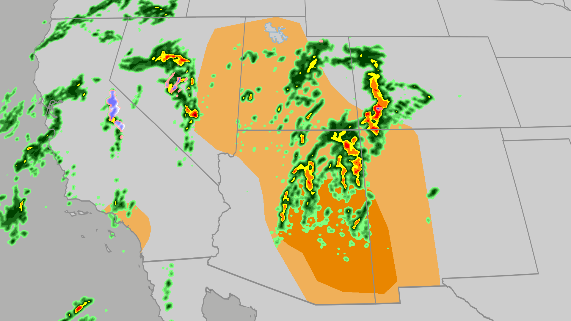 Severe weather, flood risk across Four Corners, California
The Weather Channel Tornadoes, flooding, large hail possible in Four Corners, California Parts of the Four Corners and Southern California face an elevated risk of severe weather on Thursday, which includes the…
Sun & moon
Nearby
- M’Bahiakro 46 km
- Prikro 12 km
- Ouellé 50 km
- Kouassi-Datékro 57 km
- Yorobodi 58 km
- Satama-Sokoura 40 km
- Satama-Sokoro 57 km
- Bonguéra 24 km
- Zanzansso 45 km
- Sandégué 56 km
- Ananda 57 km
- Dimandougou 42 km
Forecasts, observations and alerts in the United States come from the National Weather Service (NOAA); radar from NOAA's Multi-Radar Multi-Sensor system; satellite imagery from NASA's Global Imagery Browse Services (GIBS) and NOAA's GOES satellites; the map from the U.S. Geological Survey's National Map; air quality from AirNow (EPA and its partners); hurricane information from the National Hurricane Center; climate normals and records from NOAA's Regional Climate Centers (ACIS). Forecasts outside the United States and the UV index: MET Norway (CC BY 4.0); observations outside the U.S.: airport reports via NOAA's Aviation Weather Center. Place names: GeoNames (CC BY 4.0). Data are copied on a schedule and may lag the sources; for warnings that affect your safety, follow your local National Weather Service office and emergency officials. Weather news is drawn from the 4Conservative index and reflects what the press published. Terms of use.