Install
Mariana, Minas Gerais, Brazil Weather
Current conditions
Forecast for this hour (no station report in the last two hours)
Forecast
10-day-
Thursday
Heavy rain. High 25°. Precipitation 7.0 mm for the day.
-
Thursday Night
Rain. Low 18°. Precipitation 7.0 mm for the day.
-
Friday
Heavy rain. High 27°. Precipitation 23.5 mm for the day.
MET Norway forecast updated 1 day ago.
Hourly
Hourly forecast- Now19°0.6
- 02:0019°0.3
- 03:0019°0.3
- 04:0019°0.3
- 05:0018°0.2
- 06:0018°
- 07:0018°0.2
- 08:0019°0.2
- 09:0020°0.2
- 10:0022°0.2
- 11:0023°
- 12:0024°0.2
- 13:0025°1.4
- 14:0023°1.0
- 15:0022°0.4
- 16:0023°0.3
- 17:0022°0.4
- 18:0020°0.2
- 19:0020°
- 20:0020°
- 21:0020°
- 22:0019°
- 23:0019°
- Fri00:0019°
Daily forecast
DetailsRadar
Full mapWeather news near Mariana
More weather news-
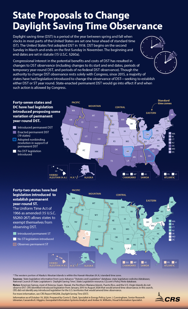 State Proposals to Change Daylight Saving Time Observance
October 19, 2026 IG10102 State Proposals to Change Daylight Saving Time Observance Daylight saving time (DST) is a period of the year between spring and fall when clocks in most parts of the United States are set one…
-
 Super Typhoon Champi churns across Pacific as another tropical threat begins to take shape
☔ 🌊 TRACKING CHAMPI: Super Typhoon Champi continues to churn in the Pacific basin and has reached strength equivalent to a Category 5 Atlantic Hurricane, with wind gusts expected to exceed 160 mph this week. The Pacific…
-
 Fall Back, Daylight Saving Time Ends Sunday November 1, 2026
It’s that time of the year, and a sign that winter is just around the corner, as Daylight Saving Time ends at 2 am Sunday, November 1, 2026. According to timeanddate.com, “In the U.S., Daylight Saving Time – or “fast…
-
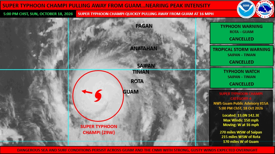 Champi exits Marianas
At 4:00 pm ChST, Super Typhoon Champi was located 170 miles west of Guam near 13.0N 142.3E. This was 215 miles west-southwest of Rota and 270 miles west-southwest of Saipan. Champi was still moving quickly west (270…
-
 Everything you need to know about the clocks changing in 2026
As we figure out how to change the time on our cars and appliances, it's only natural to question the purpose of daylight savings time - and when it might come to an end. When do the clocks change in 2026? In Ireland…
-
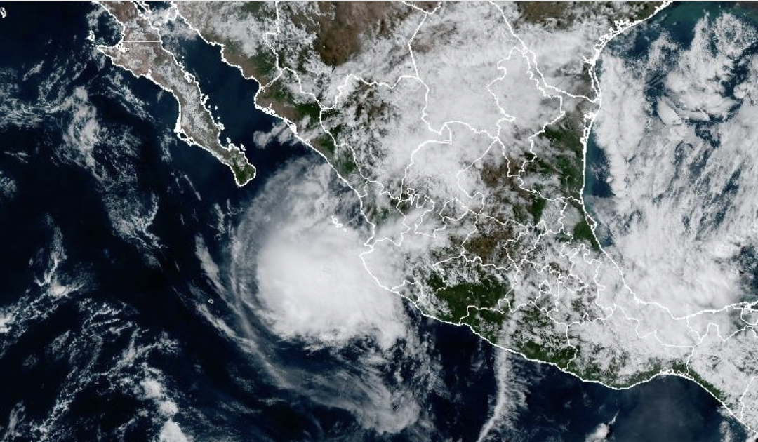 Hurricane Trudy Hits Mexican Coastline With Heavy Rainfall, Strong Winds
The Eastern Pacific’s active hurricane season remains ongoing as Hurricane Trudy churns off the coast of Central Mexico on Oct. 18. Trudy’s trajectory, which passes by a part of Mexico’s coastline that protrudes to the…
-
 Hurricane Trudy lashes Mexico’s Pacific coast with heavy rain and strong winds
Mexico Extreme Weather Pacific This GOES-19 GeoColor satellite image provided by the National Oceanic and Atmospheric Administration (NOAA) and taken on Thursday, Oct. 15 2026, shows Hurricane Trudy in the Pacific…
-
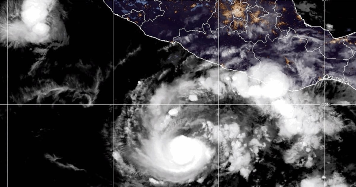 Hurricane Trudy brings heavy rain and strong winds to Mexico’s Pacific coast
MIAMI — Hurricane Trudy lashed parts of Mexico’s Pacific coast with heavy rain and strong winds Sunday but was forecast to move away, the U.S. National Hurricane Center said. The Category 2 hurricane was packing maximum…
-
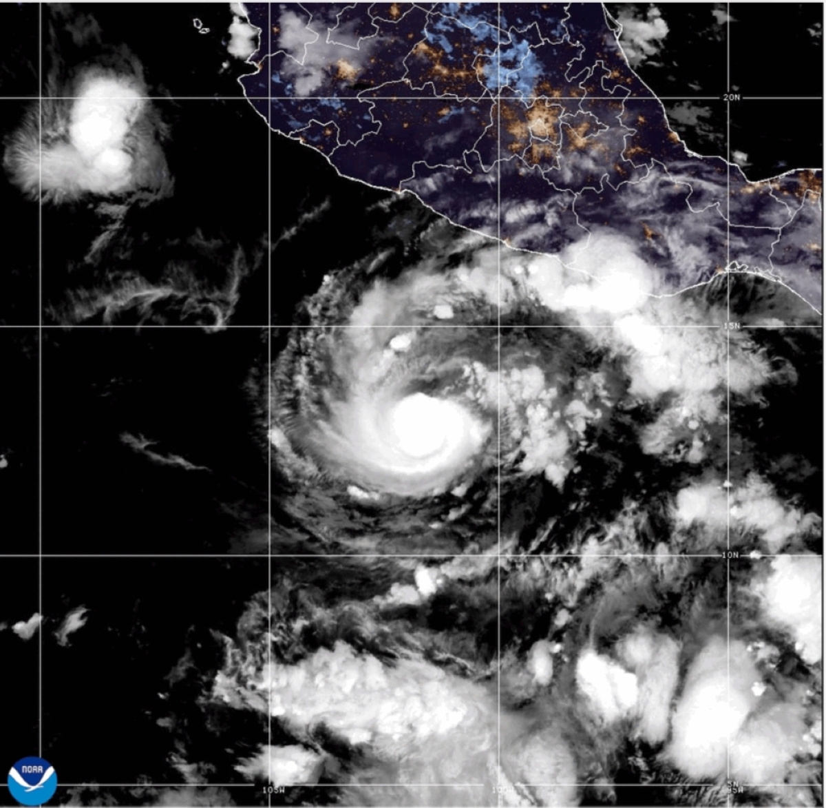 Hurricane Trudy grows stronger, nears Mexico
MIAMI — Trudy strengthened to a Category 2 hurricane as it moved toward Mexico’s southwestern and west-central Pacific coast on Saturday, the US National Hurricane Center said. A hurricane warning was in effect from…
-
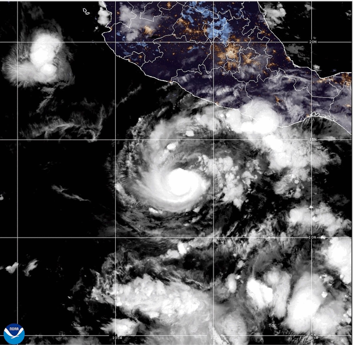 Hurricane Trudy strengthens to Category 2 as it approaches Mexico coast
MIAMI -- Trudy strengthened to a Category 2 hurricane as it moved toward Mexico 's southwestern and west-central Pacific coast on Saturday, the U.S. National Hurricane Center said. A hurricane warning was in effect from…
Sun & moon
Nearby
- Conselheiro Lafaiete 50 km
- Ouro Preto 9 km
- Ponte Nova 53 km
- Itabirito 42 km
- Congonhas 48 km
- Ouro Branco 33 km
- Barão de Cocais 49 km
- Santa Bárbara 47 km
- Piranga 36 km
- Alvinópolis 49 km
- Rio Piracicaba 56 km
- Porto Firme 48 km
Forecasts, observations and alerts in the United States come from the National Weather Service (NOAA); radar from NOAA's Multi-Radar Multi-Sensor system; satellite imagery from NASA's Global Imagery Browse Services (GIBS) and NOAA's GOES satellites; the map from the U.S. Geological Survey's National Map; air quality from AirNow (EPA and its partners); hurricane information from the National Hurricane Center; climate normals and records from NOAA's Regional Climate Centers (ACIS). Forecasts outside the United States and the UV index: MET Norway (CC BY 4.0); observations outside the U.S.: airport reports via NOAA's Aviation Weather Center. Place names: GeoNames (CC BY 4.0). Data are copied on a schedule and may lag the sources; for warnings that affect your safety, follow your local National Weather Service office and emergency officials. Weather news is drawn from the 4Conservative index and reflects what the press published. Terms of use.