Install
Warnes, Santa Cruz Department, Bolivia Weather
Current conditions
Forecast for this hour (no station report in the last two hours)
Forecast
10-day-
Wednesday
Partly cloudy. High 32°.
-
Wednesday Night
Partly cloudy. Low 27°.
-
Thursday
Partly cloudy. High 33°.
MET Norway forecast updated 7 hrs ago.
Hourly
Hourly forecast- Now28°
- 21:0028°
- 22:0027°
- 23:0027°
- Thu00:0026°
- 01:0026°
- 02:0026°
- 03:0026°
- 04:0026°
- 05:0025°
- 06:0025°
- 07:0026°
- 08:0028°
- 09:0029°
- 10:0031°
- 11:0032°
- 12:0032°
- 13:0033°
- 14:0033°
- 15:0033°
- 16:0032°
- 17:0031°
- 18:0030°
- 19:0029°
10-day forecast
DetailsRadar
Full mapWeather news near Warnes
More weather news- Thailand monitors Typhoon Champi as Taiwan travellers warned
The Thai Meteorological Department (TMD) is monitoring Typhoon Champi and has advised travellers heading to Taiwan from October 21 to 24 to closely follow weather and flight updates as the storm approaches the island…
-
 Mozambique: INAM warns of strong winds
The southern region of the country is expected to be hit by strong winds from this afternoon, according to the latest bulletin from the National Institute of Meteorology (INAM). It states that gusts o... Mozambique…
-
 South East Queensland warned to brace for severe storms and rainfall in coming days
Residents in South East Queensland are urged to keep the brolly close by, as the region prepares for more rain after already experiencing days of heavy showers. The Sunshine State has experienced steady rain over the…
-
 Malawi to roast in 42C heatwave as experts warn lives could be at risk
Malawi is set to swelter under a brutal heatwave this week, with temperatures predicted to soar to a scorching 42C in some areas, prompting urgent health warnings from authorities. The Department of Climate Change and…
-
 BBC Weather warns UK faces first named storm of season as maps show snow falling
The Met Office says gales and heavy rain are possible on Thursday and Friday(Image: WXCharts) The first named storm of the autumn could hit the UK this week, forecasters have warned. Atlantic weather systems are…
-
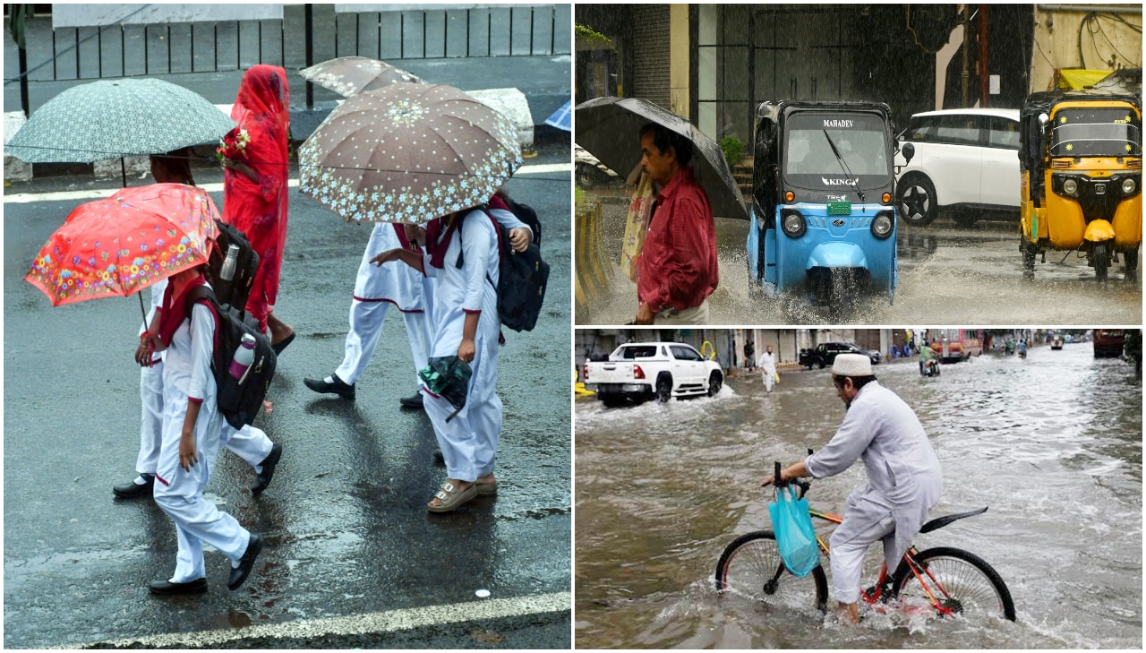 Weather tomorrow October 20: IMD warns of rain, thunderstorms in Kerala, Karnataka, yellow alert in 17 Tamil Nadu districts – Check forecast for Delhi, Rajasthan, UP, Himachal
According to the weather department, most parts of Delhi and the adjoining National Capital Region (NCR), including Noida, Ghaziabad, Faridabad and Gurugram, will remain dry, with no rainfall predicted. No significant…
-
 U.S. Officials Warn of Stormier South, Putting Disney World Travel at Risk
If you've ever packed a poncho “just in case,” a new federal weather map may make you feel prepared. NOAA's latest seasonal outlook, covering December 2026 through February 2027, shades the Walt Disney World Resort area…
-
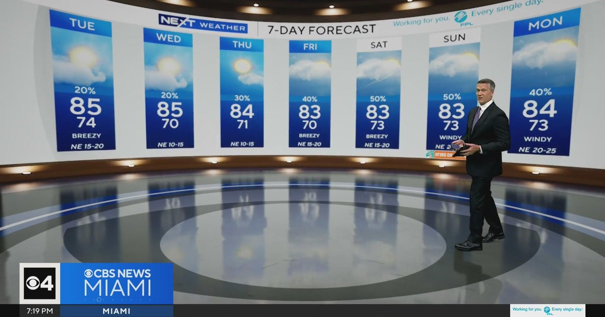 Temperatures lower to the early 80s and late 70s throughout South Florida
CBS News Miami is a local news organization that is part of CBS News and Stations. Also referred to as WFOR-TV and channel 4, CBS News Miami offers local breaking news, weather coverage and investigative reporting…
-
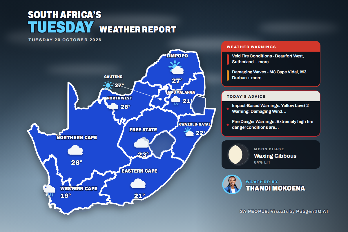 Here is today’s weather by province: Damaging waves expected along the KwaZulu-Natal coast today
Home » Here is today’s weather by province: Damaging waves expected along the KwaZulu-Natal coast today Mahikeng swings from a chilly 6°C at dawn to the country’s warmest reading of 28°C, while Cape Town tops out at…
- Monday, Oct. 19, 2026: Spotty showers, temps in the 80s
Download our free KRGV FIRST WARN 5 Weather app for the latest updates right on your phone. Monday, Oct. 19, 2026: Spotty showers, temps in the 80s You can also follow our KRGV First Warn 5 Weather team on Facebook and…
Sun & moon
Nearby
- Santa Cruz de la Sierra 30 km
- Montero 22 km
- Cotoca 36 km
- El Torno 59 km
- Mineros 45 km
- Okinawa Uno 44 km
- Portachuelo 30 km
- Pailón 50 km
- San Julian 44 km
- La Bélgica 6 km
- Okinawa Número Uno 49 km
- Buena Vista 54 km
Forecasts, observations and alerts in the United States come from the National Weather Service (NOAA); radar from NOAA's Multi-Radar Multi-Sensor system; satellite imagery from NASA's Global Imagery Browse Services (GIBS) and NOAA's GOES satellites; the map from the U.S. Geological Survey's National Map; air quality from AirNow (EPA and its partners); hurricane information from the National Hurricane Center; climate normals and records from NOAA's Regional Climate Centers (ACIS). Forecasts outside the United States and the UV index: MET Norway (CC BY 4.0); observations outside the U.S.: airport reports via NOAA's Aviation Weather Center. Place names: GeoNames (CC BY 4.0). Data are copied on a schedule and may lag the sources; for warnings that affect your safety, follow your local National Weather Service office and emergency officials. Weather news is drawn from the 4Conservative index and reflects what the press published. Terms of use.