Install
Southampton Parish, Southampton, Bermuda Weather
Current conditions
Forecast for this hour (no station report in the last two hours)
Forecast
10-day-
Sunday
Heavy rain. High 24°. Precipitation 19.2 mm for the day.
-
Sunday Night
Heavy rain. Low 23°. Precipitation 19.2 mm for the day.
-
Monday
Rain. High 27°. Precipitation 2.9 mm for the day.
MET Norway forecast updated 8 hrs ago.
Hourly
Hourly forecast- Now23°2.5
- 19:0024°1.2
- 20:0024°0.4
- 21:0024°
- 22:0024°0.2
- 23:0024°0.3
- Mon00:0025°1.3
- 01:0025°0.5
- 02:0026°0.2
- 03:0027°
- 04:0027°
- 05:0027°
- 06:0027°
- 07:0027°
- 08:0027°
- 09:0027°
- 10:0027°
- 11:0026°
- 12:0026°
- 13:0026°
- 14:0025°
- 15:0025°0.4
- 16:0025°0.4
- 17:0025°
10-day forecast
DetailsRadar
Full mapWeather news in Bermuda
More weather news-
 Weather Forecast For Sunday October 25
Sunday, October 25 is expected to be cloudy and windy with increasing rain and showers, with the high to be near 23°C/74°F and the low to be near 21°C/69°F, according to the Bermuda Weather Service. Winds are expected…
- Wednesday evening video forecast
Crisp nights, warm afternoons, and sunny skies aren't going anywhere anytime soon. While it’s ideal weather to spend time outdoors, the dry conditions elevate fire risks, so exercise extra caution ... Wednesday evening…
-
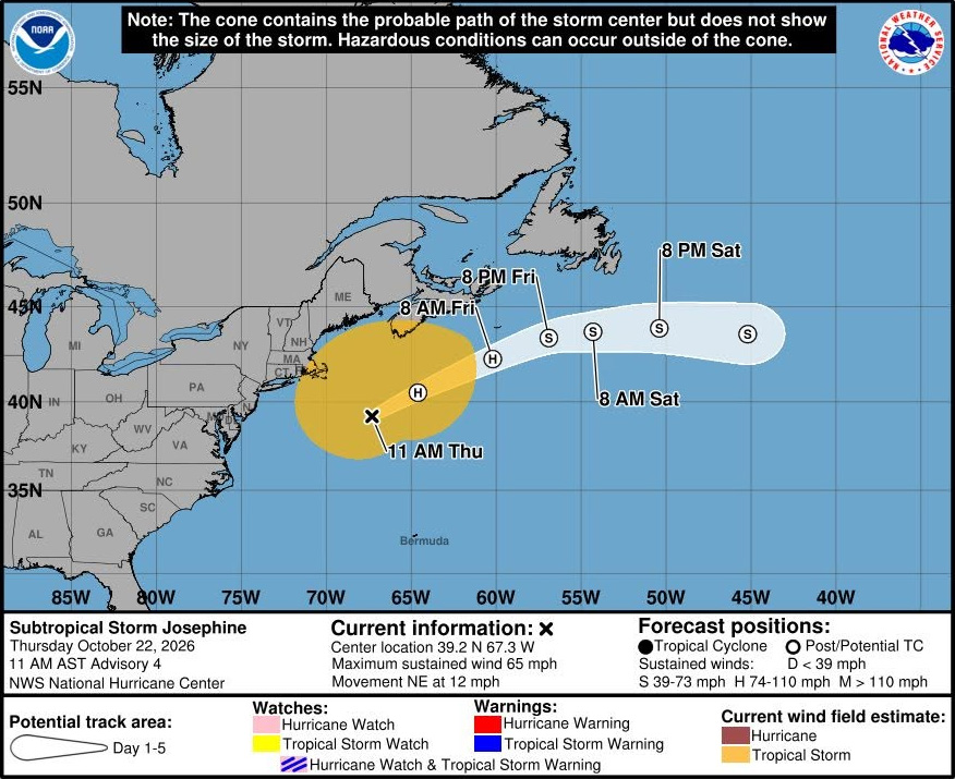 BWS: Josephine Brings High Swells To Bermuda
The Bermuda Weather Service [BWS] is warning of high swells from Subtropical Storm Josephine and potentially gale-force winds, heavy showers and gusts exceeding 40 knots from Sunday into Monday. The BWS posted the…
-
 Josephine, now a strong post-tropical cyclone, churns rough seas from Florida coast to Northeast
Subtropical Storm Josephine transitioned into an extratropical low Thursday afternoon, although it remained a powerful system generating dangerous swells and coastal flooding. Josephine will continue to bring high…
-
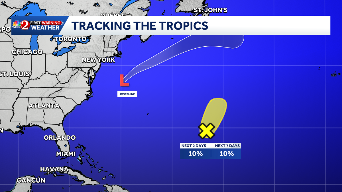 NHC monitors Atlantic system near Bermuda for possible tropical development
The National Hurricane Center is monitoring a low-pressure trough in the central Atlantic that could develop over the next couple of days. The trough was located several hundred miles to the east-southeast of Bermuda…
-
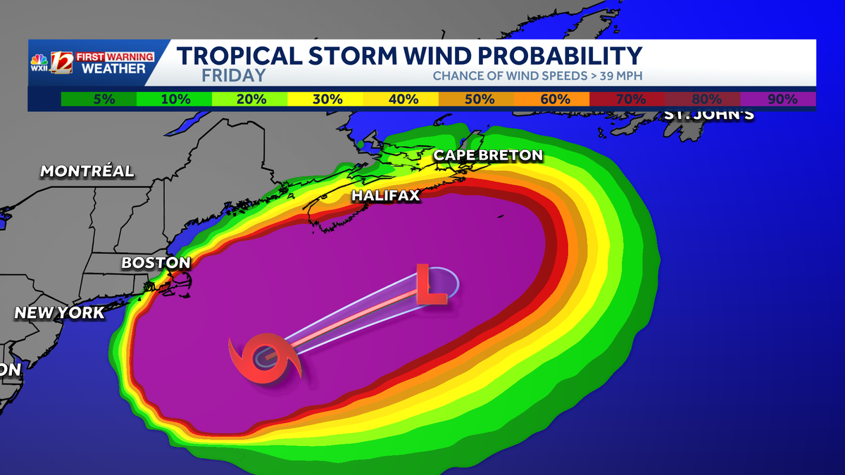 Post-tropical storm Josephine accelerating away from U.S. | NC flood, high wave impact continues
Rough surf and high waves along the North Carolina Outer Banks will subside over the weekend as powerful Josephine races into the North Atlantic. The extratropical low that was Subtropical Storm Josephine will intensify…
- Hurricane Center tracking Josephine, system off Bermuda. Florida impacts?
Subtropical Storm Josephine became the 10th named storm of the 2026 Atlantic hurricane season Oct. 21, two weeks after Tropical Storm Isaias formed in the Gulf. Josephine is forecast to move northeast into the northern…
-
 FIRST ALERT FORECAST: Warm weather continues as the drought worsens
LAKE CHARLES, La. (KPLC) - The drought continues to expand across SWLA with little-to-no rain is expected at least for another week. The dry air again will drop temperatures to the low-to-mid 50’s Friday morning before…
-
 Weather Forecast For Friday October 23
Friday, October 23 is expected to be generally sunny despite a few showers around, with the high to be near 24°C/75°F and the low to be near 21°C/70°F, according to the Bermuda Weather Service. Winds are expected to be…
-
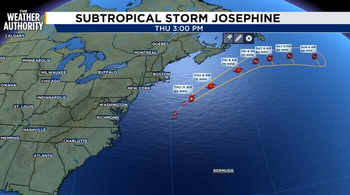 Josephine Strengthens, Moves Northeast Toward Extratropical Transition
Josephine is moving northeast and is expected to become a strong extratropical storm later today. The center of Subtropical Storm Josephine was located near latitude 39.2 North, longitude 67.3 West. The storm has…
Sun & moon
Nearby
- Warwick Parish 5 km
- Sandys Parish 5 km
- Devonshire Parish 11 km
- Hamilton Parish 15 km
- Paget Parish 7 km
- St George's Parish 20 km
- Smith's Parish 13 km
Forecasts, observations and alerts in the United States come from the National Weather Service (NOAA); radar from NOAA's Multi-Radar Multi-Sensor system; satellite imagery from NASA's Global Imagery Browse Services (GIBS) and NOAA's GOES satellites; the map from the U.S. Geological Survey's National Map; air quality from AirNow (EPA and its partners); hurricane information from the National Hurricane Center; climate normals and records from NOAA's Regional Climate Centers (ACIS). Forecasts outside the United States and the UV index: MET Norway (CC BY 4.0); observations outside the U.S.: airport reports via NOAA's Aviation Weather Center. Place names: GeoNames (CC BY 4.0). Data are copied on a schedule and may lag the sources; for warnings that affect your safety, follow your local National Weather Service office and emergency officials. Weather news is drawn from the 4Conservative index and reflects what the press published. Terms of use. How to use Weather