Install
Young, New South Wales, Australia Weather
Current conditions
Forecast for this hour (no station report in the last two hours)
Forecast
10-day-
Thursday
Light showers. High 24°. Precipitation 1.9 mm for the day.
-
Thursday Night
Partly cloudy. Low 12°. Precipitation 1.9 mm for the day.
-
Friday
Heavy rain. High 23°. Precipitation 4.2 mm for the day.
MET Norway forecast updated 2 hrs ago.
Hourly
Hourly forecast- Now15°
- 01:0014°
- 02:0013°
- 03:0013°
- 04:0012°
- 05:0012°
- 06:0012°
- 07:0013°
- 08:0015°
- 09:0018°
- 10:0019°
- 11:0021°
- 12:0023°
- 13:0024°
- 14:0024°
- 15:0024°0.8
- 16:0022°0.7
- 17:0022°0.3
- 18:0021°
- 19:0020°
- 20:0019°
- 21:0018°
- 22:0017°
- 23:0016°
Daily forecast
DetailsRadar
Full mapWeather news near Young
More weather news-
 First rain of the season to arrive in Bay Area Tuesday night
SAN FRANCISCO (KRON) -- The first rain of the season is due to arrive in the Bay Area Tuesday night, according to the National Weather Service. The NWS is advising of rain showers continuing through Thursday morning…
-
 A dry and very pleasant week is on the way with lots of sunshine and highs mainly in the 50s.
Tonight will be clear and crisp but not as cold as Saturday night. Lows will be mainly in the 30s, though parts of northern New York and the Champlain Valley may remain in the low 40s. Monday will be a fantastic…
-
 ‘Dangerous mistake’ Brits make when heating homes in winter - expert issues warning
Families with young babies need to take particular care because infants cannot regulate their body temperature as effectively as adults. Mr McKenzie said: “For families with young babies, warming the home properly is…
-
 Cold front brings coolest air of the season so far to Midstate
WLFI Cold front brings coolest air of the season so far to Midstate Capital City Pride festival focused on visibility, acceptance for LGBTQ community Passenger left injured at scene of crash, young driver arrested Pope…
-
 October 18th Weather Forecast
fox10tv.com October 18th Weather Forecast Capital City Pride festival focused on visibility, acceptance for LGBTQ community Passenger left injured at scene of crash, young driver arrested Pope Leo discharged from…
-
 Yellow Level 2 warning issued for KZN as severe storms approach
Updated Oct. 18, 2026, 8:03 a.m. | By Asa Gxigxa Residents and motorists are urged to take precautions against possible flooding, infrastructure damage and small hail. A yellow Level 2 warning has been issued for KZN on…
- Honolulu Weather Forecast For A Breezy, Showery Weekend
Honolulu is starting Saturday mostly clear and warm, with temperatures near 78 degrees at the airport. The city should reach about 85 degrees, though isolated rain showers and brisk east-northeast winds will keep the…
- Santa Ana Sizzle: San Diego Bakes Under Heat Advisory Before Midweek Storms
San Diego is waking up Saturday to dry air and temperatures already around 81 degrees, with the afternoon expected to climb near 91. A Heat Advisory remains in effect through 8 p.m., making this a hot and potentially…
-
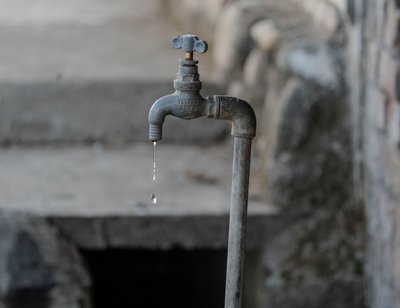 KZN warned to prepare for El Niño as water scarcity fears grow
Updated Oct. 17, 2026, 11:25 a.m. | By Aerusha Naidoo KwaZulu-Natal communities are being urged to prepare for the potential effects of El Niño, which could bring drier conditions and increase the risk of water…
-
 Tracking winds picking up across Arizona this morning
AZ Family Tracking winds picking up across Arizona this morning Man arrested for Phoenix crash that killed young girl, injured mother Young boy struck by family's SUV in Queen Creek driveway Phoenix mental health clinic…
Sun & moon
Nearby
- Cootamundra 44 km
- Grenfell 48 km
Forecasts, observations and alerts in the United States come from the National Weather Service (NOAA); radar from NOAA's Multi-Radar Multi-Sensor system; satellite imagery from NASA's Global Imagery Browse Services (GIBS) and NOAA's GOES satellites; the map from the U.S. Geological Survey's National Map; air quality from AirNow (EPA and its partners); hurricane information from the National Hurricane Center; climate normals and records from NOAA's Regional Climate Centers (ACIS). Forecasts outside the United States and the UV index: MET Norway (CC BY 4.0); observations outside the U.S.: airport reports via NOAA's Aviation Weather Center. Place names: GeoNames (CC BY 4.0). Data are copied on a schedule and may lag the sources; for warnings that affect your safety, follow your local National Weather Service office and emergency officials. Weather news is drawn from the 4Conservative index and reflects what the press published. Terms of use.