Install
Dayboro, Queensland, Australia Weather
Current conditions
Forecast for this hour (no station report in the last two hours)
Forecast
10-day-
Wednesday
Heavy rain. High 24°. Precipitation 10.8 mm for the day.
-
Wednesday Night
Light rain. Low 15°. Precipitation 10.8 mm for the day.
-
Thursday
Heavy rain. High 20°. Precipitation 18.6 mm for the day.
MET Norway forecast updated 9 hrs ago.
Hourly
Hourly forecast- Now21°0.2
- 09:0022°
- 10:0024°2.4
- 11:0020°3.4
- 12:0020°1.8
- 13:0020°0.5
- 14:0022°1.2
- 15:0020°0.5
- 16:0021°0.2
- 17:0020°
- 18:0019°0.2
- 19:0018°
- 20:0018°
- 21:0018°
- 22:0018°
- 23:0018°
- Thu00:0017°0.3
- 01:0017°
- 02:0017°0.2
- 03:0017°1.4
- 04:0017°1.1
- 05:0017°1.0
- 06:0017°1.5
- 07:0018°1.7
Daily forecast
DetailsRadar
Full mapWeather news near Dayboro
More weather news- Brisbane the coldest capital as week of rain to soak south-east
October 19, 2026 — 11:11am Brisbane was forecast to remain colder than other Australian capital cities on Monday, with a band of rain sitting over the state’s south-east expected to remain until early next week. The…
-
 ‘Unusual’: Queensland expecting a month’s worth of rain in one week
The West Australian is a leading news source in Perth and WA. Breaking local and world news from sport and business to lifestyle and current affairs. After being drenched by torrential downpour over the weekend…
-
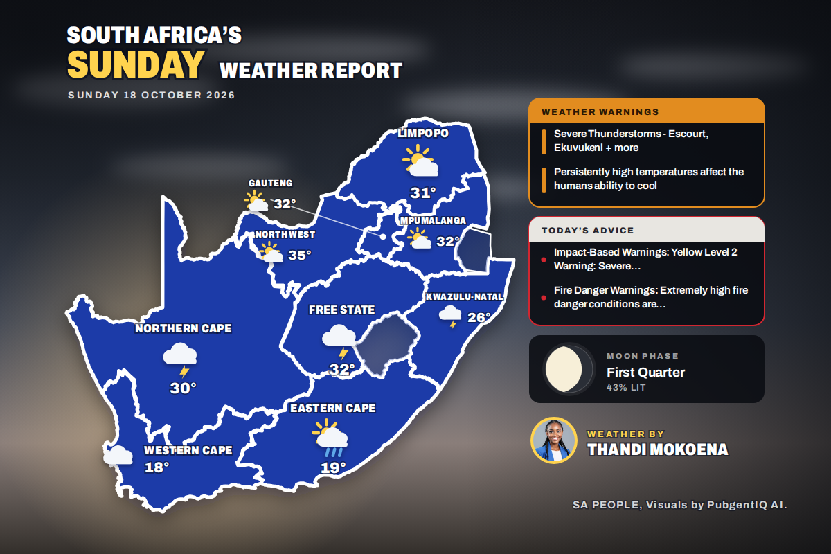 Here is today’s weather by province: Severe thunderstorms threaten Ladysmith Escourt and Dannhauser today
Home » Here is today’s weather by province: Severe thunderstorms threaten Ladysmith Escourt and Dannhauser today Mahikeng is the hottest spot at 35°C, while Cape Town peaks at just 18°C beneath cloud and a fresh SSE…
- El Nino’s are meant to be dry. So what’s with all this rain?
October 17, 2026 - 2.08am Sydneysiders couldn’t leave the house without an umbrella this week with parts of the city copping more than 110mm of rain. Parts of Melbourne have also seen up to 300mm of rain this month. SES…
-
 Geebung Weather
Brisbane for Saturday. Cloudy. Medium chance of showers, becoming less likely in the afternoon. Winds E/SE 15 to 25 km/h becoming light in the late evening. 16 Oct, 3:46AM UTC 16 Oct, 1:58AM UTC Prolonged period of…
- El Niño set to be wettest on record as storms soak Australia's east
This year remains on track to become Australia's wettest El Niño year on record, and the first ever with above-average national winter-spring rainfall. October has been particularly damp thanks to an ongoing outbreak of…
- Strong winds and storms in central Queensland set to roll into weekend
A lightning storm passed over properties in the Charleville region into Thursday evening. (Supplied: Nick Sheehan) Storms that have lashed parts of central Queensland could continue through the weekend and reach parts…
-
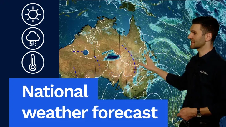 National weather forecast: A blocking high sets up in the Tasman Sea
And the main feature is going to be this blocking high in the Tasman Sea. You can see it centred near Tasmania on Friday. It’s going to remain pretty much in that spot for the next several days. And that means really…
- Blocking High Develops Over Tasman Sea
And the main feature is going to be this blocking high in the Tasman Sea. You can see it centred near Tasmania on Friday. It's going to remain pretty much in that spot for the next several days. And that means really…
-
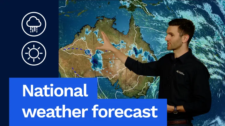 National weather forecast: Storms possible for most of Australia
The Bureau of Meteorology Javascript is disabled. Information may not appear correctly. For the best website experience, activate Javascript. National weather forecast: Storms possible for most of Australia Video…
Sun & moon
Nearby
- Brisbane 36 km
- Logan City 57 km
- Caloundra 53 km
- Narangba 14 km
- Capalaba 54 km
- Woodridge 56 km
- Mango Hill 21 km
- Kelvin Grove 34 km
- Lowood 39 km
- Elimbah 24 km
- Maleny 49 km
- Fernvale 33 km
Forecasts, observations and alerts in the United States come from the National Weather Service (NOAA); radar from NOAA's Multi-Radar Multi-Sensor system; satellite imagery from NASA's Global Imagery Browse Services (GIBS) and NOAA's GOES satellites; the map from the U.S. Geological Survey's National Map; air quality from AirNow (EPA and its partners); hurricane information from the National Hurricane Center; climate normals and records from NOAA's Regional Climate Centers (ACIS). Forecasts outside the United States and the UV index: MET Norway (CC BY 4.0); observations outside the U.S.: airport reports via NOAA's Aviation Weather Center. Place names: GeoNames (CC BY 4.0). Data are copied on a schedule and may lag the sources; for warnings that affect your safety, follow your local National Weather Service office and emergency officials. Weather news is drawn from the 4Conservative index and reflects what the press published. Terms of use.